Satellite and aerial maps of Ostend / Bruges with nearby locations
| Nearby locations | Km | Bearing | |
|---|---|---|---|
| Oostende Heliport , West-Vlaanderen | 0.9 | 226 | EBNH |
| | 5.4 | 067 | |
| Zedelgem / Aartrijke , West-Vlaanderen | 16.6 | 119 | EBZA |
| Koksijde / Coxyde AB , West-Vlaanderen | 19.7 | 229 | EBFN |
| Diksmuide Heliport , West-Vlaanderen | 20.2 | 181 | EBDI |
| | 20.4 | 221 | EBVS |
Ostend / Bruges |
| 51° 11' 59'' N 2° 51' 49'' E | ||
| Middelkerke, Oostende, West-Vlaanderen | ||
| ICAO: EBOS | IATA: OST | |
| Elevation: 13 feet | ||
The Vlaams Luchtvaart Opleiding Centrum (VLOC), which contains a number of instructional airframes, is situated on the NW side of the airport, north of the helipad. 
Ostend / Bruges News |

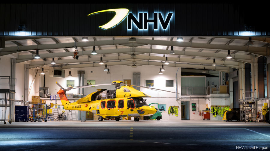
NHV Celebrates 25th Anniversary
02-May-22 - In 1997, Noordzee Helikopters Vlaanderen (NHV) began helicopter operations from Ostend, Belgium. Today operates +40 helicopters in offshore missions in Europe and Western Africa #25anniversary