Satellite and aerial maps of Lanvéoc-Poulmic with nearby locations
| Nearby locations | Km | Bearing | |
|---|---|---|---|
| Ile Longue helipad , Bretagne | 5.7 | 286 | LFYB |
| | 10.8 | 331 | |
| Amiraute , Bretagne | 11.4 | 341 | LFRX |
| | 11.5 | 348 | |
| | 14.9 | 334 | HCB |
| Gorré-Ménez , Bretagne | 15.9 | 035 |
Lanvéoc-Poulmic |
1930 to present | ||
| 48° 16' 57'' N 4° 26' 37'' W | ||
| 1nm W of Lanvéoc, Lanveoc, 29 Finistère, Bretagne | ||
| ICAO: LFRL | IATA: | |
| Elevation: 287 feet | ||
Major civil works began on the base in 1930 to support the defence of the main naval base at Brest, which itself was strategically placed for the Western Approaches and the North Atlantic. During WWII the base was occupied and in the run up to the Normandy landings was extensively damaged both by Allied action and local sabotage. In 1944, it was decided to rebuild as a main Marine Nationale air base and is today a major rotary wing shore base in support of units of the Atlantic Fleet. 
List of units at Lanvéoc-Poulmic |
| Years | Unit | |
|---|---|---|
| 2021- | 34F | Alouette III, AS365 Dauphin 2, |
| 2011- | 33F | NH90 NFH, |
| 1979/98 | 35F | SA365 Dauphin 2, AS365 Dauphin 2, Alouette II, Alouette III, Lynx, SA360 Dauphin, HSS-1 Seabat, |
| 1975/20 | 34F | Lynx, Alouette III, |
| 1964- | 32F | H160, EC225LP, SA365 Dauphin 2, SE3210 Super Frelon, HSS-1 Seabat, |
| 1964/21 | 22S | AS365 Dauphin 2, EC120, Alouette III, Alouette II, |
Lanvéoc-Poulmic News |
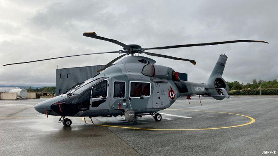
French Navy Receives Its Fourth H160 Interim Helicopter
24-Sep-23 - Babcock delivered the fourth of six Airbus H160 FI maritime search and rescue (SAR) interim helicopter to the French Navy #France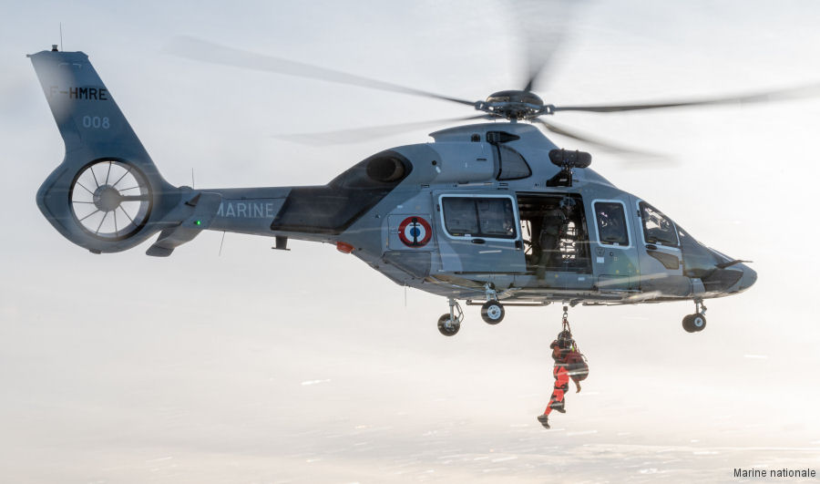
French Navy Continues Evaluation of H160 FI
10-Apr-23 - The French Navy leased interim helicopter Airbus H160 FI ( flotte intérimaire ) continues evaluations before being declared operational with the Flotille 32F #H160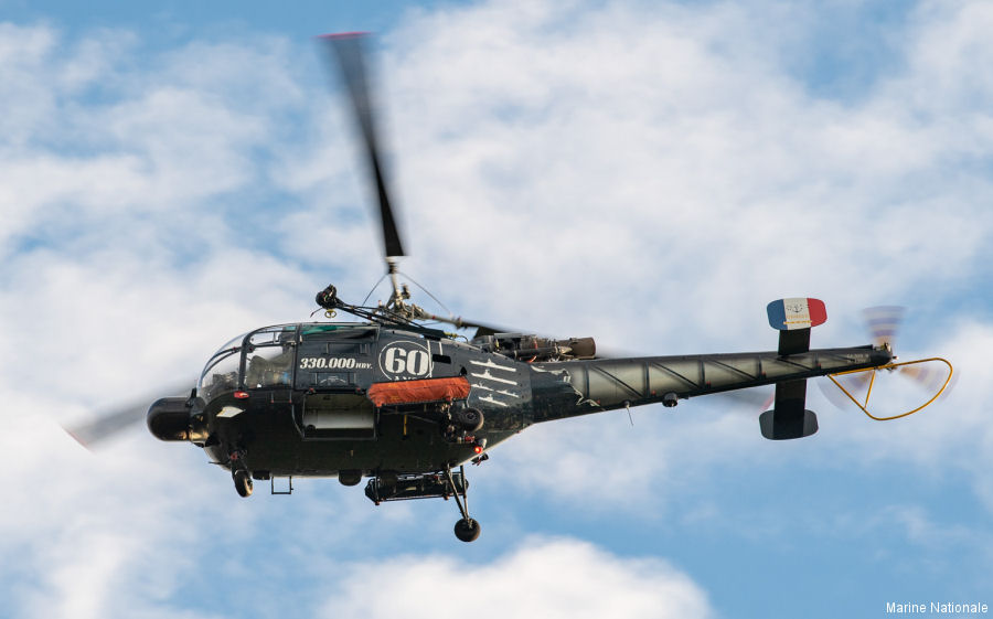
French Navy Retires Alouette III
10-Dec-22 - The French Navy retired the Alouette III helicopter after 60 years of service. #AlouetteIII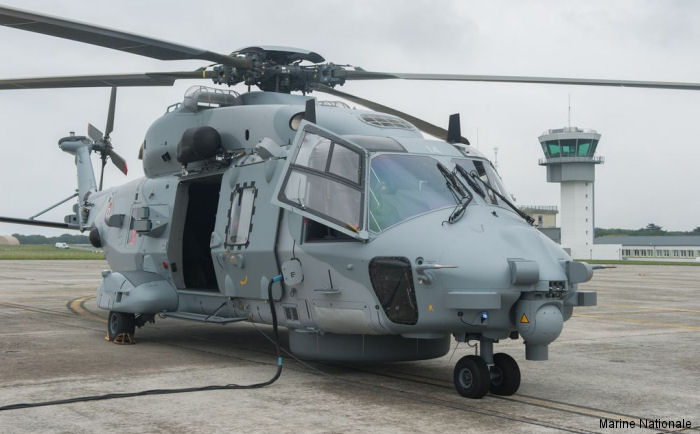
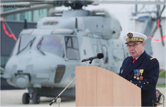
14th NH90 Caiman Delivered to French Navy
21-Aug-15 - Fourteen and last Step B NH90 NFH Caiman was delivered to the French Navy and assigned to the 33F Squadron