Satellite and aerial maps of Kalaeloa Airport / John Rodgers Field with nearby locations
Kalaeloa Airport / John Rodgers Field |
1942 to present | | 21° 18' 28.88'' N 158° 4' 18.26'' W | | 2m S of Makakilo, O'ahu, Hawaii | | ICAO: PHJR | IATA: NAX | FAA: JRF | | Elevation: 30 feet |
Formely known as Naval Air Station Barbers Point. In July 1999 the Navy left the airport after the BRAC (base realignment and closure) cut and was renamed to its current form.
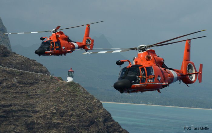
Is also homebase for Coast Guard Air Station Barbers Point
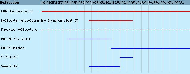
List of units at Kalaeloa Airport / John Rodgers Field |
Kalaeloa Airport / John Rodgers Field News |
17-Feb-17 - U.S. Coast Guard MH-65 Dolphin helicopters based at Barbers Point Air Station rescued seven people in less than 12 hours
|
|
Helicopters for sale
Accidents
Acronyms
Airshows
Future helicopters
Flying a helicopter
Helicopter stories
TV and movies
Helicopter books
Helicopter patches
Helicopter model kits

|