Satellite and aerial maps of Blacksod Point with nearby locations
| Nearby locations | Km | Bearing | |
|---|---|---|---|
| Belmullet Aerodrome , Connacht | 14.0 | 008 | EIBT |
| | 17.3 | 258 | |
| Scotchport HLS , Connacht | 17.4 | 357 | |
| | 20.5 | 354 | |
| | 21.9 | 030 | |
| | 27.7 | 164 |
Blacksod Point |
1969 to present | ||
| 54° 5' 54.5'' N 10° 3' 41'' W | ||
| Fallmore, Belmullet, Mayo, Connacht |
The Light was opened in Jun 1866 and electrified in May 1967. It became the centre for Helicopter operations around the Mullet Peninsula in 1969.
Weather reports from Blacksod Point Light by Keeper E Sweeney in early Jun 1944 played a key role in General Eisenhowers decision on the timing of D-Day for the Allied invasion of Europe.
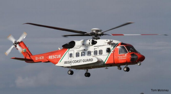
Blacksod Point was a key location for the search and recovery of S-92 Rescue 116, which crashed during a mission west of Black Rock Island on 14 Mar 2017.
Weather reports from Blacksod Point Light by Keeper E Sweeney in early Jun 1944 played a key role in General Eisenhowers decision on the timing of D-Day for the Allied invasion of Europe.
Blacksod Point was a key location for the search and recovery of S-92 Rescue 116, which crashed during a mission west of Black Rock Island on 14 Mar 2017.
List of units at Blacksod Point |
| Years | Unit | |
|---|---|---|
| 1969- | Lighthouse Operations | |
Blacksod Point News |