Satellite and aerial maps of Philippine Sea with nearby locations
| 20° 0' 0.00'' N 130° 0' 0.00'' E | | |
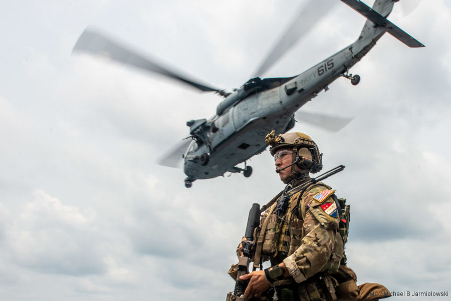
14-Jun-22 - US Navy Helicopter Sea Combat Squadron HSC-12 “Golden Falcons” deployed aboard aircraft carrier USS Ronald Reagan (CVN 76) in the Philippine Sea completed a Helicopter Visit, Board, Search and Seizure (HVBSS) exercise #HVBSS
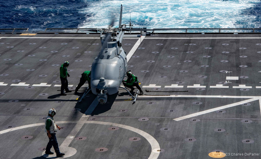
24-May-22 - The Bell / Northrop Grumman MQ-8C Fire Scout drone helicopter is in their first deployment to the Indo-Pacific with US Navy Helicopter Sea Combat Squadron HSC-23 aboard littoral ship USS Jackson (LCS-6) #drones
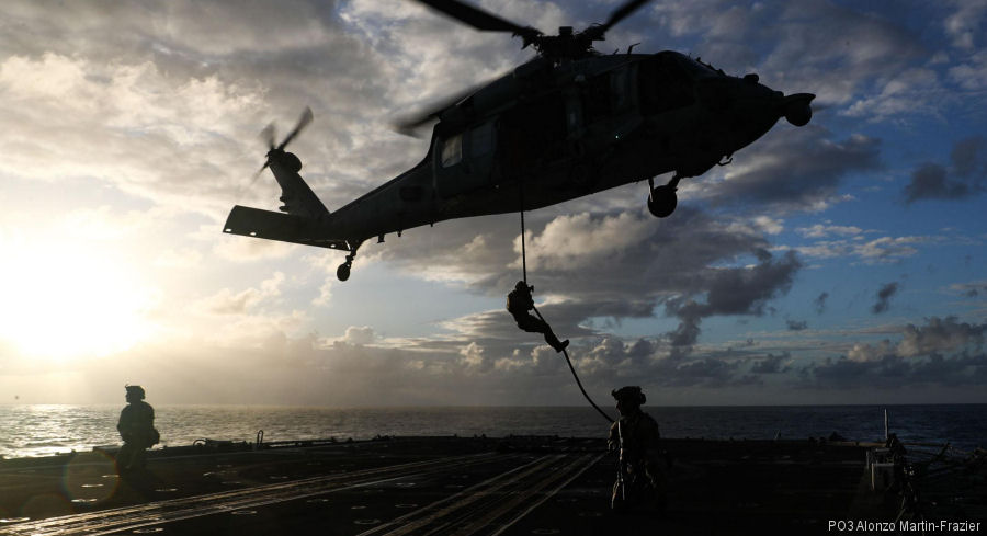
22-May-22 - US Helicopter Sea Combat Squadron HSC-14, “Chargers”, completed helicopter visit, board, search and seizure (HVBSS) training with Explosive Ordnance Disposal Mobile Unit EODMU-3 aboard USS Abraham Lincoln on the Philippine Sea #Chargers
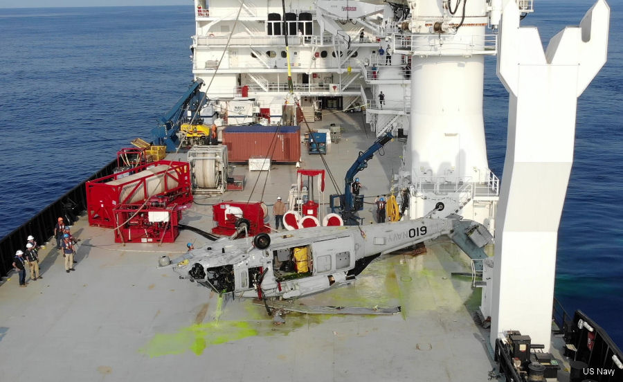
23-Mar-21 - The US Navy recovered a MH-60S Seahawk helicopter that crashed last year off the coast of Okinawa, Japan from a record depth of 19,075 feet ~ 5814 meters #depth
List of aircraft and events at Philippine Sea |
|
|
Helicopters for sale
Accidents
Acronyms
Airshows
Future helicopters
Flying a helicopter
Helicopter stories
TV and movies
Helicopter books
Helicopter patches
Helicopter model kits

|