Satellite and aerial maps of Freetown with nearby locations
| Nearby locations | Km | Bearing | |
|---|---|---|---|
| | 20.8 | 215 | SLFNA |
| Hastings Airport , Western Area | 25.8 | 163 | GFHA |
| Moyamba , Southern Province | 97.7 | 121 | |
| Conakry Intl , | 116.1 | 336 | GUCY |
| Gbangbatok Airport , Southern Province | 127.0 | 134 | GFGK |
| Bonthe , Southern Province | 141.8 | 148 | GFBN |
Freetown |
| 8° 37' 0.50'' N 13° 11' 47.90'' W | ||
| Kambia, Freetown, North Western Province | ||
| ICAO: GFLL | IATA: FNA | |
| Elevation: 93 feet | ||
Freetown News |
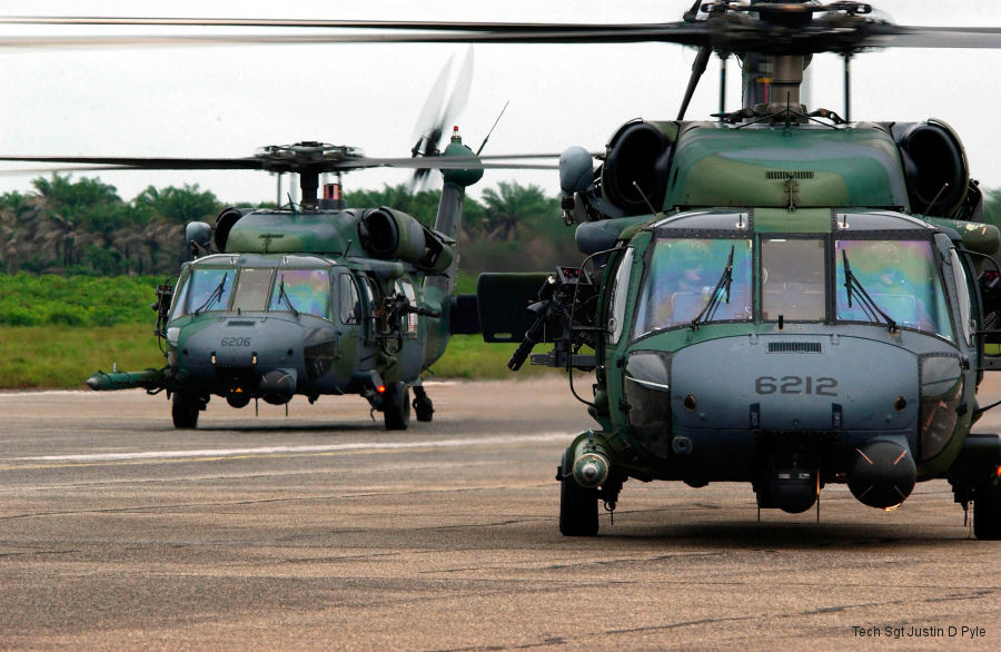
56th ERQS Pave Hawks Deployed to Liberia
23-Jul-03 - USAF HH-60G Pave Hawks from the 56th Expeditionary Rescue Squadron (ERQS) based at NAS Keflavik flew a Marine antiterrorism security team from Sierra Leone to the US Embassy in Monrovia, Liberia List of aircraft and events at Freetown |
| Dates | Org/Type | Unit | ||
|---|---|---|---|---|
| 2003-jul-23 | USAF | HH-60G | 88-26109 | |
| 2003-jul-23 | USAF | HH-60G | 89-26206 | |
| 2003-jul-23 | USAF | HH-60G | 89-26212 |
