--- SL --- ( switch sort order ) -- Freetown Port -- Moyamba GFBN -- Bonthe GFBO -- Bo GFGK -- Gbangbatok Airport GFHA -- Hastings Airport GFKB -- Kabala Airport GFKE -- Kenema Airport GFLL -- Freetown GFYE -- Yengema Airport ---- More Bases ----
Lungi International Airport Freetown , North Western Province
Sierra Leone
Lungi International Airport, Dr.Ernest Bai Koroma Road, Kambia, Mahera, Port Loko District, North West Province, Sierra Leone, Sierra Leone 8° 37' 0.50'' N 13° 11' 47.90'' W Kambia, Freetown, North Western Province ICAO: GFLL IATA: FNA Elevation: 93 feet
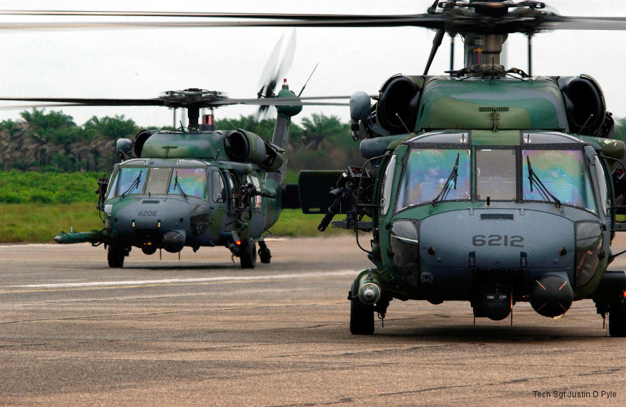
23-Jul-03 - USAF HH-60G Pave Hawks from the 56th Expeditionary Rescue Squadron (ERQS) based at NAS Keflavik flew a Marine antiterrorism security team from Sierra Leone to the US Embassy in Monrovia, Liberia
List of aircraft and events at Freetown
Helicopters for sale Accidents Acronyms Airshows Future helicopters Flying a helicopter Helicopter stories TV and movies Helicopter books Helicopter patches Helicopter model kits