Satellite and aerial maps of Beale AFB with nearby locations
Yuba County, California, United States
1960 to present | | 39° 8' 9.96'' N 121° 26' 13.19'' W | | 6nm E of Marysville, Marysville, California | | ICAO: KBAB | IATA: BAB | FAA: BAB | | Elevation: 112 feet |
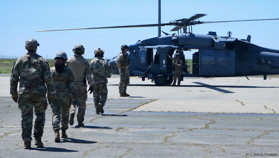
13-May-23 - USAF 129th Rescue Squadron provided the first-ever helicopter familiarization training at Beale AFB under the new AFFORGEN model. The 9th Civil Engineer Squadron learned basic operating procedures aboard a Pave Hawk helicopter #AFFORGEN
|
|
Helicopters for sale
Accidents
Acronyms
Airshows
Future helicopters
Flying a helicopter
Helicopter stories
TV and movies
Helicopter books
Helicopter patches
Helicopter model kits

Download App
|