Satellite and aerial maps of Cable with nearby locations
Cable Airport, Airport Drive, College Heights, Upland, San Bernardino County, California, 91786, United States
1945 to present | | 34° 6' 41.80'' N 117° 41' 14.59'' W | | Upland, California | | ICAO: KCCB | IATA: CCB | FAA: CCB | | Elevation: 1443 feet |
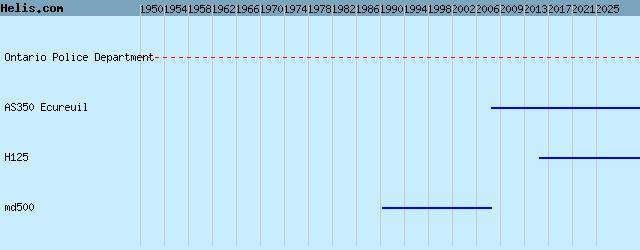
List of aircraft and events at Cable |
By Date | By Serial | By Model
|
|
Helicopters for sale
Accidents
Acronyms
Airshows
Future helicopters
Flying a helicopter
Helicopter stories
TV and movies
Helicopter books
Helicopter patches
Helicopter model kits

Download App
|