Satellite and aerial maps of Winslow Regional with nearby locations
Winslow-Lindbergh Regional Airport, 1048, Airport Road, Winslow, Navajo County, Arizona, 86047, United States
| 35° 1' 18.10'' N 110° 43' 22.50'' W | | 1nm W of Winslow, Winslow, Arizona | | ICAO: KINW | IATA: INW | FAA: INW | | Elevation: 4941 feet |
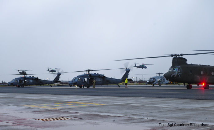
05-Jun-15 - Angel Thunder 2015 saw US Army CH-47D Chinooks, German Air Force CH-53GS and USAF HH-60G Pave Hawk helicopters along students from local universities in a mass casualty exercise in northern Arizona
List of aircraft and events at Winslow Regional |
|
|
Helicopters for sale
Accidents
Acronyms
Airshows
Future helicopters
Flying a helicopter
Helicopter stories
TV and movies
Helicopter books
Helicopter patches
Helicopter model kits

Download App
|