NAS Oceana det Norfolk / Chambers Field
NAS Norfolk
KNGU · NGU
1918-
 Norfolk, VA, Norfolk, Virginia
36.937462, -76.289261 · 16 feet
Norfolk Naval Station (Chambers Field), Gilbert Street, Norfolk, Virginia, 23511, United States
Nearby Locations
| Km | |||
|---|---|---|---|
| 3.6 | 286° | ||
| 6.5 | 329° | ||
| VA88 | 8.5 | 189° | |
| Norfolk International Airport | KORF | 9.2 | 121° |
| 71VA | 10.8 | 319° | |
| 11.4 | 102° |
News


- Nov 3, 2020 · Pax River SAR Rescued Hawkeye Crew
- Sep 21, 2020 · First MQ-8C Fire Scout Drone for HSC-22
- Jun 16, 2020 · HSC-11 Completes 9-Month Deployment
- May 25, 2020 · Navy Squadron Maintains Readiness During COVID-19
- Sep 17, 2018 · HSC-7 Seahawks Prepositioned for Hurricane Florence
- Jul 16, 2018 · First Flight for All US Navy Crew in Osprey
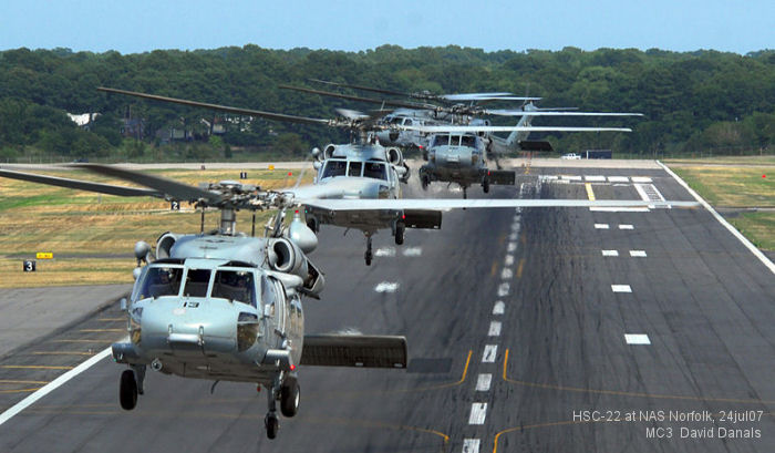
- Apr 22, 2016 · HM-14 Conducts Five Helicopter Formation