Satellite and aerial maps of Felts Field with nearby locations
Felts Field Airport, Bolstad, Parkwater, Spokane, Spokane County, Washington, 99211, United States
1937 to present | | 47° 40' 58.60'' N 117° 19' 20.71'' W | | 4nm NE of Spokane, Spokane, Washington | | ICAO: KSFF | IATA: SFF | FAA: SFF | | Elevation: 1956 feet |
List of units at Felts Field |
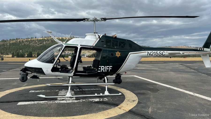
01-Apr-23 - Trakka Systems provided a total mission solution package for Washington’s Spokane County sheriff OH-58 helicopter including the TrakkaCam TC-300, TrakkaBeams TLX and TM-100 mapping system #Spokane
|
|
Helicopters for sale
Accidents
Acronyms
Airshows
Future helicopters
Flying a helicopter
Helicopter stories
TV and movies
Helicopter books
Helicopter patches
Helicopter model kits

Download App
|