Satellite and aerial maps of Port Vila with nearby locations
Nearby locations | Km | Bearing | |
---|---|---|---|
Naone , Penama | 301.5 | 355 | NVSN |
Port Vila |
17° 41' 57.57'' S 168° 19' 11.26'' E | ||
Port Vila, Shefa | ||
ICAO: NVVV | IATA: VLI |
Port Vila News |
Satellite and aerial maps of Port Vila with nearby locations
Indago UAV Used in Cyclone Pam Disaster Relief Efforts
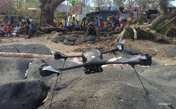
04-May-15 - Following the devastation of Cyclone Pam in Vanuatu, Australian operator Heliwest used Lockheed Martin Indago small unmanned aerial system (UAS) to collected imagery of the damage #CyclonePamAirbus Helicopters Foundation Aid to Vanuatu
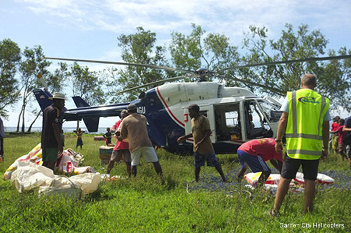
01-Apr-15 - The Airbus Helicopters Foundation partnered with New Zealand operator Garden City Helicopters to provide aid in Vanuatu following tropical cyclone Pam #CyclonePamAustralian Operation Pacific Assist 2015
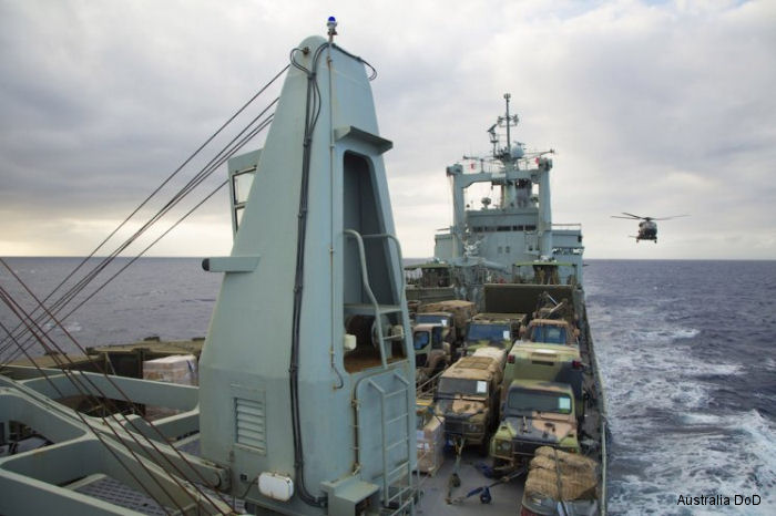
30-Mar-15 - Australian humanitarian assistance continues to flow into the most heavily affected areas by Cyclone Pam of Vanuatu. More than 500 ADF personnel are deployed as part of Operation Pacific Assist 2015 #CyclonePam | Helicopters for sale Accidents Acronyms Airshows Future helicopters Flying a helicopter Helicopter stories TV and movies Helicopter books Helicopter patches Helicopter model kits |