 Aintree University Hospital
Aintree University Hospital
2017-
 Fazakerley, Liverpool, Merseyside, England
53.465361, -2.929097 · 70 feet
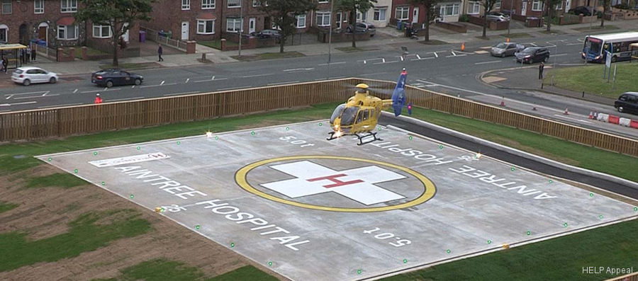
Broadway, Clock Tower Park, Fazakerley, Liverpool, Liverpool City Region, England, L9 7LJ, United Kingdom
Nearby Locations
| Km | |||
|---|---|---|---|
| GBAIN | 1.7 | 313° | |
| 3.2 | 310° | ||
| EGF37 | 5.6 | 159° | |
| Simonswood | EGF38 | 5.7 | 039° |
| GBLIV | 5.8 | 235° | |
| 6.4 | 264° |


