Satellite and aerial maps of Raoul Island with nearby locations
Raoul Island |
| 29° 16' 37.00'' S 177° 55' 24.02'' W | ||
| Kermadec Islands |
Raoul Island News |
|
Satellite and aerial maps of Raoul Island with nearby locations
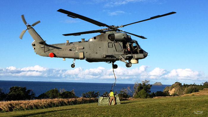
First Mission for New SH-2G (I) Seasprite15-Sep-16 - New Zealand ’s newly acquired SH-2G(I) Seasprite first operational mission with an offshore patrol vessel (OPV) resupply the Kermadec Islands | Helicopters for sale Accidents Acronyms Airshows Future helicopters Flying a helicopter Helicopter stories TV and movies Helicopter books Helicopter patches Helicopter model kits  Download App | |||||||||