Satellite and aerial maps of Lydd with nearby locations
| Nearby locations | Km | Bearing | |
|---|---|---|---|
| Shorncliffe , England | 19.5 | 045 | |
| | 20.8 | 355 | EGA39 |
| Hawkinge , England | 22.7 | 040 | |
| Challock , England | 29.1 | 344 | EGKE |
| Lashenden Headcorn , England | 30.5 | 317 | EGKH |
| | 31.9 | 056 | GBDVR |
Lydd |
1954 to present | ||
| 50° 57' 21.77'' N 0° 56' 20.97'' E | ||
| 12nm S of Ashford, Lydd, Kent, England | ||
| ICAO: EGMD | IATA: LYX | |
| Elevation: 13 feet | ||
Base for the famous Bristol Freighter car transport service to France.
As result of the closure of Manston on the north Kent coast, the planned SAR service there needed a new home. On a temporary basis, SAR services commenced from Lydd in Aug 2015 and it was announced in Apr 2016 that this would become the permanent base for the life of the current contract.
Works began for a new, modular, 2 airframe SAR base and hangar in Jun 2017.
List of units at Lydd |
| Years | Unit | |
|---|---|---|
| 2015- | Lydd sector | AW189, AW139, |
Lydd News |
Award for HM Coastguard Lydd Crewman
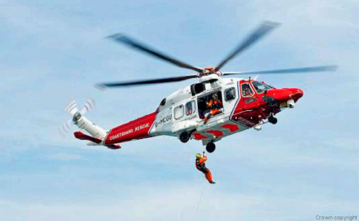
29-Jun-21 - A prestigious Royal Humane Society award has been presented to HM Coastguard SAR Lydd helicopter winch paramedic Mark Scotland following his heroic actions to save a 12-year-old girl off the coast of Kent last year #crewman
Coastguard Lydd Base Passes 1,000 Rescues
03-Aug-20 - The HM Coastguard Search and Rescue (SAR) base at Lydd, Kent completed their 1,000th tasking since beginning lifesaving operations in 2015. Operated by Bristow, started with AW139 until the introduction of the AW189. Lydd helicopters responds to around 16 incidents per month #rescues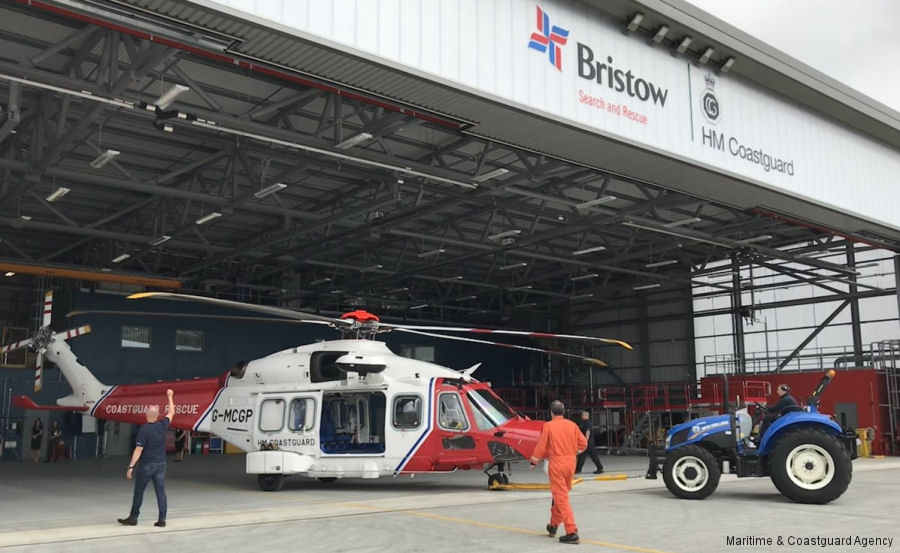
UK SAR New Coastguard Facility Opens at Lydd
12-Jul-18 - HM Coastguard officially opened the new base at Lydd, Kent. Equipped with AW189 operated by Bristow #coastguard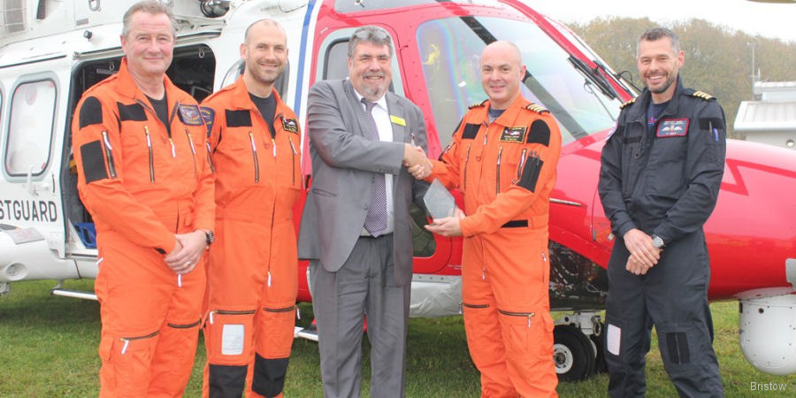
Bristow Lydd SAR Team Honoured
25-Oct-17 - Bristow Search and Rescue (SAR) team based at Lydd Airport, 32 individuals, honoured for its work. They conducted 425 SAR operations since August 2015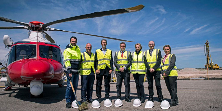
Ground-Breaking at Lydd SAR Base
20-Jun-17 - Ground has been broken at Lydd Airport starting construction of the new HM Coastguard helicopter base for the south-east operated by Bristow Helicopters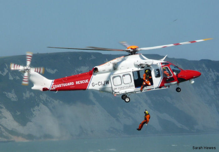
Bristow First Anniversary of SAR in Lydd
16-Aug-16 - Bristow search and rescue (SAR) AW139 operations on behalf of the Maritime and Coastguard Agency from the base at London Ashford Airport responded to over 180 taskings during their first year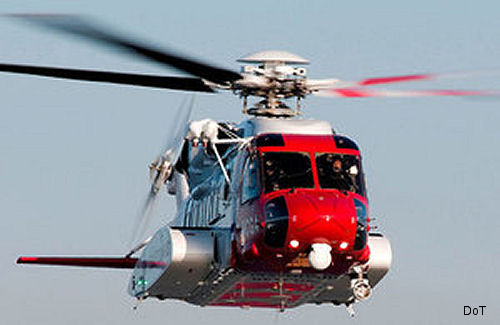
Lydd Airport Made Permanent Home for SAR
13-Apr-16 - The Department for Transport announced that Lydd Airport will be the permanent base for the UK Coastguard’s search and rescue helicopter services in the south-east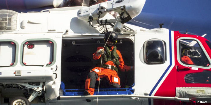
HMS Echo Lends a Deck to Lydd Search and Rescue
02-Oct-15 - Bristow SAR AW139 based at Lydd performed a winch training exercise with HMS Echo, a Plymouth-based survey ship returning back from the North Sea
