Satellite and aerial maps of Sonoma County with nearby locations
Sonoma County Airport, 2200, Airport Boulevard, Santa Rosa, Sonoma County, California, 95403, United States
| 38° 30' 34.90'' N 122° 48' 46.40'' W | | 2.5nm S of Windsor, Santa Rosa, California | | ICAO: KSTS | IATA: STS | FAA: STS | | Elevation: 128 feet |
List of units at Sonoma County |
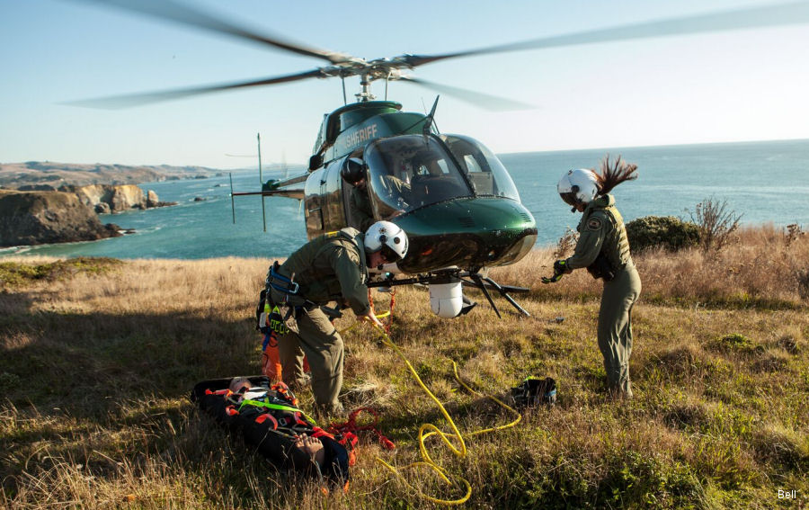
22-Jun-20 - Let’s meet the crew of Sonoma County Sheriff’s Bell 407GXP helicopter, called Henry One, used daily in parapublic and rescue missions #HenryOne
|
|
Helicopters for sale
Accidents
Acronyms
Airshows
Future helicopters
Flying a helicopter
Helicopter stories
TV and movies
Helicopter books
Helicopter patches
Helicopter model kits

Download App
|