Satellite and aerial maps of La Rochelle-Laleu airport with nearby locations
La Rochelle-Laleu airport |
1939 to present | | 46° 10' 45.16'' N 1° 11' 42.85'' W | | Île de Re, La Rochelle, 17 Charente-Maritime, Nouvelle-Aquitaine | | ICAO: LFBH | IATA: LRH | | Elevation: 74 feet |
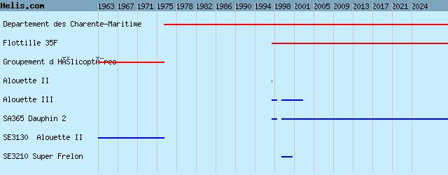
List of units at La Rochelle-Laleu airport |
La Rochelle-Laleu airport News |
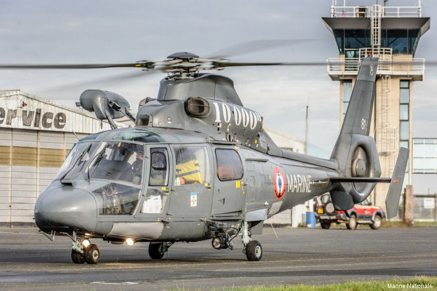
03-Feb-19 - French Navy’ SA365 Dauphin #6081 reaches 10,000 flight hours in 28 years of rescues. Assigned to 35F SAR Detachment at La Rochelle airport which carried out 1773 takeoffs on alert and rescued 823 people since its creation in 1993 #Rochelle
List of aircraft and events at La Rochelle-Laleu airport |
|
|
Helicopters for sale
Accidents
Acronyms
Airshows
Future helicopters
Flying a helicopter
Helicopter stories
TV and movies
Helicopter books
Helicopter patches
Helicopter model kits

|